Campo magnético de la Tierra. |
By Gustavo Zavala Grundy / Posted on octubre 12, 2020 / No comments
GEOFÍSICA - PROSPECCIÓN GEOFÍSICA
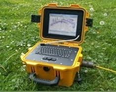
Cuando hacemos estudios en Prospección Eléctrica estudiamos también el potencial natural del subsuelo, ello nos permite conocer si existe en la zona algún cuerpo geológico o zona mineralizada que esté alterando el campo natural en un determinado punto y/o área. Cuando no existe algún tipo de perturbación en una determinada área por lo general encontraremos valores de diferencia de potencial similares, cuya diferencia no es tan pronunciada, esto debido también a que el subsuelo es heterogéneo. En cambio, cuando en la zona existe algún cuerpo o existe mineralización, el potencial natural de esa zona variará con respecto a otros puntos de dicha zona, la cual nos da un indicio de que existe algo que está perturbando el campo potencial natural de nuestra área de estudio. El campo de potencial natural lo podemos medir con voltímetros.
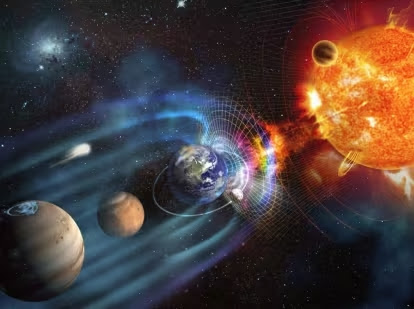
Uno de los campos naturales más importantes de nuestro planeta es el campo magnético. Estos campos los podemos medir con ayuda de instrumentos llamados magnetómetros. Las líneas de fuerza del campo magnético recorren toda la superficie de nuestro planeta, así que, podemos medir su valor en cualquier punto de la Tierra. Este campo natural se origina desde el núcleo de la Tierra, debido al movimiento de fluido existente en el núcleo externo, los metales y materiales friccionan entre sí generando el campo magnético que envuelve a toda a Tierra, y el responsable de protegernos de las diversas radiaciones provenientes del espacio exterior. De igual manera que con el campo potencial natural, el campo magnético toma valores similares en diversos puntos equidistantes, no siendo el caso cuando existe algún cuerpo mineralizado que altera en determinado punto el campo magnético, a este valor se le agregará una determinada magnitud al valor promedio del campo magnético de una línea base creada con anterioridad. La Prospección Magnética se encarga de estudiar esto mismo.
Otro de los campos naturales importantes de nuestro planeta es el campo gravitatorio. Específicamente al referirnos cuando aplicamos Prospección Gravimétrica en un determinado estudio. La prospección gravimétrica hace referencia a la gravedad en un punto específico en un área determinada. Esto quiere decir, que en un punto específico está presente la gravedad que en condiciones normales, como en los demás campos, al no existir un cuerpo geológico que altere el campo gravitatorio por medio de la densidad de su masa, mostrará valores gravitatorios normales, es decir sin alteraciones. Caso contrario, al existir un cuerpo extraño en profundidad, éste debido a su masa y a su densidad cambiará las propiedades físicas de ese punto, y por ende el valor de la gravedad en ese punto variará en relación a su valor medio de la zona de estudio. Esta diferencia en el campo gravitatorio es observable de manera cualitativa cuando elaboramos perfiles gravimétricos. En el gráfico, mostraremos la curva normal de los valores de gravedad y la curva con los datos enviados por el equipo con su data alterada por el cuerpo geológico mostrándonos claramente que existe un cuerpo extraño que altera los valores registrados del campo gravitatorio. La forma de medir estos valores del campo gravitatorio es con la ayuda de equipos gravimétricos, que se encargan de recoger los valores de un determinado punto.
Estos son al menos los campos naturales más importantes que se estudian actualmente.
By Gustavo Zavala Grundy / Posted on octubre 09, 2020 / No comments / Categories: base de datos, equipos geofísicos, geofísica, investigación, investigación geofísica, mapas, modelamiento, modelos geofísicos, objetivos, perfiles, simulación
GEOFÍSICA - INVESTIGACIÓN
Uno de los objetivos del geofísico es iniciar investigaciones geofísicas, cuya finalidad sea el de entender, comprender, analizar, construir bases de datos o simular situaciones y momentos para poder llegar a una conclusión más exacta o certera sobre un problema que se este estudiando en una determinada zona de trabajo.
El poder entender el problema de estudio en cuestión es determinante, ya que esta comprensión nos ayudará a aplicar correctamente el método geofísico y/o el equipo específico que utilizaremos en el campo para recoger los datos crudos pertinentes que llevaremos a laboratorio para su análisis.
Comprender y analizar los datos que recogemos en campo ayudará en la elaboración del siguiente paso en nuestra investigación geofísica, la cual será la de elaborar mapas o perfiles que nos permitirá visualizar los datos que recogimos en campo en una forma gráfica, más cualitativa, logrando ayudarnos de esa manera en una primera interpretación geofísica coherente.
Mantener y guardar esos datos crudos o datos trabajados, a lo que llamamos nuestra base de datos, nos ayudarán en un futuro a la continuación de la investigación geofísica de dicha zona, o nos permitirá usarlos como ejemplos aproximados, pero no iguales, de los datos de nuestra base de datos.
La alimentación de nuestra base de datos en un periodo de tiempo nos ayuda a realizar trabajos de investigación geofísica de una forma mas desarrollada y compleja, es decir, nos permitirá desarrollar modelos de simulación o crear modelamiento geofísico. Estos modelos le darán más sostenibilidad a nuestra investigación geofísica en la cual estamos trabajando. Los modelos geofísicos nos ayudan a visualizar de una manera más intuitiva y dinámica los datos de nuestra base de datos. A comparación de los mapas y perfiles creados anteriormente, estos modelos nos ayudan a ver el comportamiento dinámico de los modelos geofísicos creados en un periodo de tiempo determinado o con miras al tiempo futuro, todo dependiendo del alcance que estemos desarrollando.
Para construir estos modelos geofísicos nos basaremos en diversas variables, Estas variables son múltiples y dependerán del tipo de investigación que desarrollemos. La cantidad de precipitación, magnitudes de sismos, dirección del viento, son solo algunos ejemplos de variables que podemos usar en una investigación geofísica. Para construir estos modelos analizar las diferentes fórmulas matemáticas y leyes físicas que gobiernan determinados eventos geofísicos es determinante e importante. Tener conocimientos en matemáticas y física es primordial al introducirnos a realizar una investigación geofísica que nos brinde resultados reales.
Recordemos que una investigación geofísica puede ser amplia. Esto depende de los objetivos de nuestra investigación, los cuales se han determinado en la etapa previa a la investigación. Los objetivos de la investigación geofísica deben ser claros y específicas, de ello dependerá del tipo de equipo geofísico que utilizaremos para recoger los datos en campo. El uso de un buen equipo geofísico es importante, ya que un buen equipo nos brindará la confianza en los datos recogidos con la mínima cantidad de errores, los cuales siempre existirán. Un buen equipo en nuestra investigación minimizará estos errores, no en su totalidad, pero sí los reducirá.
Existen varios ejemplos de investigación geofísica los cuales podemos abordar. Por citar algunas de ellas encontraremos investigaciones en aguas subterráneas, investigaciones a nivel de profundidad, ello conduce a estudios de secciones geoeléctricas al analizar resistividades del subsuelo. Investigaciones geofísicas en meteorología y climatología en la elaboración de modelos climáticos y predicciones del tiempo. Además de realizar investigaciones en sismología reuniendo bases de datos de sismos y sus parámetros.
By Gustavo Zavala Grundy / Posted on septiembre 25, 2020 / No comments
GEOFISICA - IMPACTO AMBIENTAL
BIBLIOGRAPHIC REFERENCE
(1) https://es.wikipedia.org/wiki/Di%C3%B3xido_de_nitr%C3%B3geno
(2) http://www.esa.int/Space_in_Member_States/Spain/Disponibles_mapas_globales_de_contaminacion_del_aire
It is remarkable that due to the presence of COVID-19 on our planet many things have changed, in addition to our habits in a personal and collective way, but even so despite this, our planet has had a respite, a period of rest time , making this opportunity a clear sign of the decrease in environmental pollution.
This is because various industries and companies have stopped their productions. The rates that were shown in times before COVID-19 had been high, but now due to the presence of COVID-19 these rates have decreased considerably. These indices can be plotted on a global "Nitrogen Dioxide" pollution map, from Europe to America. We can see the presence of this pollutant in a red hue in the various cities of any country.
This data is provided by ESA, the European Space Agency, publicly. The data presented has a period of 14 days. This online platform uses data from the Copernicus Sentinel-5P satellite. As if it were a Google Maps map, we can increase and decrease the map, move from one place to another and visualize the concentration of NO2 present. We can also change the dates of the visualization of these data to compare them over time, always remembering that they are for periods of 14 days. We share the link so that you can view the NO2 POLLUTION MAP. You can also view the map FROM HERE. (Wait 5 seconds of advertising)
We leave you some maps prepared by this online application, detailing the date range for each area studied. It is also worth mentioning that we will prepare the maps for each continent so that they can be downloaded from this post or by entering our download area for geophysicists.
NO2 Pollution Map in Africa |
NO2 Pollution Map in South America |
NO2 Pollution Map in Asia |
NO2 Pollution Map in Central America |
NO2 Pollution Map in Europe |
NO2 Pollution Map in North America |
NO2 Pollution Map in Oceania |
Remember that Nitrogen Dioxide is a by-product of combustion at high temperatures, as in motor vehicles and power plants. For this reason it is a frequent pollutant in urban areas, mainly affecting the respiratory system. (1) It should also be noted that these images can be used for research on Environmental Impact.
(1) https://es.wikipedia.org/wiki/Di%C3%B3xido_de_nitr%C3%B3geno
(2) http://www.esa.int/Space_in_Member_States/Spain/Disponibles_mapas_globales_de_contaminacion_del_aire
By Gustavo Zavala Grundy / Posted on septiembre 25, 2020 / No comments
It is natural that when we study the subsoil by injecting current, we must measure with specialized equipment the potential difference between the electrodes that we are using, to determine our apparent resistivity. In order to determine all this, we must make use of elementary mathematics and physics, which the geophysicist must always bear in mind when starting a geophysical study using any geoelectric method.
One of the considerations that we must bear in mind before injecting current into the ground is that we have to have our theoretical physical formulas well defined, one of which corresponds to Ohm's law, since the method of electrical resistivity in direct current is governed by this same law.
So what determines Ohm's Law when a flow of electrical current passes through rocks or sediments?
Ohm's General Law establishes that the potential drop ΔV between two points through which an electric current of intensity "I" circulates, is proportional to this and to the resistance "R" offered by the medium to the passage of the current (1) as expressed by the following equation:
The units of these values correspond to ohms, volts, and amps. Where we determine the volts for the potential difference. Amps for the current and ohms for resistance.
How is this equation proven?
Experimentally, it is shown that the intensity of the current that passes through a body per unit section is linearly proportional to the potential gradient (ΔV / Δl). Therefore, for any section, it will be:
where C, is the conductivity of the material, which is a constant of proportionality.
The Resistance "R" that a body opposes to the passage of electric current is directly proportional to the length and inversely proportional to the section. The constant of linear proportionality ρ (ro) is the resistivity, which is a characteristic parameter of each material.
solving and replacing we have the definition of ohm's law.
In the case of electrical prospecting studies, such as the case of Vertical Electrical Probes, and taking into account an isotropic medium, we can use Ohm's Law to calculate the resistance, multiplying it by the geometric factor of the tetraelectrodic device. Since we are injecting current into the subsoil through our poles that we have installed in the ground and at certain distances from the source of current injection. Likewise, we can measure the intensity of current that the equipment is throwing, the resistance offered by the ground and its potential difference. In this way, we can calculate with the help of our geometric factor the apparent resistivity through which the electric current circulates in the subsoil, in order to determine the type of material that exists at certain depths of study.
BIBLIOGRAPHIC REFERENCES
(1) http://tierra.rediris.es/hidrored/ebooks/miguel/ProspeccGeoelec.pdf
STUDY / SUPPORT MATERIAL
By Gustavo Zavala Grundy / Posted on septiembre 21, 2020 / No comments
Every geophysicist should always have his own work tools. One of them is to have the use of specialized software to solve various problems that are under study. Depending on the type of work or the area in which we are specializing, we will use this or that work tool. In the case of hydrogeological studies, a good package and / or development software is Modflow, which is a finite difference flow modeler, where it consists of a source code that solves the groundwater flow equation through interactions.
With Modflow we can simulate the underground flow of an aquifer. To do this, Modflow uses the flow equation for groundwater using finite differences. Then, we must take into account the following: the partial differential equation that governs the flow of groundwater and used in Modflow is the general equation of flow, in transitory regime in a heterogeneous and anisotropic medium. (1)
Here we leave you some tutorials made with Modflow where different work topics are explained.
MODFLOW TUTORIALS
You can also view more videos in our geophysical videos section.
REFERENCIAS BIBLIOGRÁFICAS
(1) https://es.wikipedia.org/wiki/Modflow#:~:text=MODFLOW%20es%20un%20modelador%20de,flujo%20subterr%C3%A1neo%20de%20cualquier%20acu%C3%ADfero.
By Gustavo Zavala Grundy / Posted on septiembre 05, 2020 / 1 comment
GEOFÍSICA - SOFTWARE GEOFÍSICO
Todo geofísico debe tener siempre sus propias herramientas de trabajo. Una de ellas es contar con el uso de software especializado para resolver diversos problemas que se encuentran en estudio. Dependiendo del tipo de trabajo o el área en que nos estemos especializando, utilizaremos tal o cual herramienta de trabajo. Uno de los tantos software existentes para estudios hidrogeológicos que podemos utilizar para complementar nuestros informes de trabajo es Modflow, el cual es un modelador de flujo por diferencias finitas, el cual consiste de un código fuente que resuelve mediante interacciones la ecuación de flujo del agua subterránea.
Con Modflow podemos simular el flujo subterráneo de un acuífero. Para ello, este programa utiliza la ecuación de flujo para agua subterránea usando diferencias finitas. Entonces, debemos tener en cuenta lo siguiente: la ecuación parcial diferencial que gobierna el flujo de agua subterránea y usada en Modflow es la "ecuación general de flujo", en régimen transitorio en medio heterogéneo y anisotrópico. (1) Algunos de los trabajos de investigación que podemos tratar con el paquete Modflow es el Modelamiento de Aguas Subterráneas, el transporte de contaminantes, Análisis de Pozos o Caudal de Bombeo. Aquí les dejamos unos tutoriales realizados con Modflow donde se explica diferentes temas de trabajo.
TUTORIALES DE MODFLOW
1. Modelamiento Regional de Aguas Subterráneas. Obtén su código de inserción |
2. Curso MODFLOW Cl-1 Instalación y descripción de Model Muse Obtén su código de inserción |
3. Tutorial de modelamiento de transporte de contaminantes con MODFLOW Obtén su código de inserción |
4. Tutorial para el Modelamiento y Análisis de Interferencia de Pozos con MODFLOW Obtén su código de inserción |
5. Tutorial de Determinación de Máximo Caudal de Bombeo con MODFLOW Obtén su código de inserción |
También puedes visualizar más vídeos en nuestra sección de vídeos geofísicos.
REFERENCIAS BIBLIOGRÁFICAS
(1) https://es.wikipedia.org/wiki/Modflow#:~:text=MODFLOW%20es%20un%20modelador%20de,flujo%20subterr%C3%A1neo%20de%20cualquier%20acu%C3%ADfero.
By Gustavo Zavala Grundy / Posted on septiembre 01, 2020 / 1 comment
GEOFÍSICA - PROSPECCIÓN GEOFÍSICA
Es natural que cuando estudiamos el subsuelo inyectando corriente, debemos medir con equipos especializados la diferencia de potencial entre los electrodos que estamos utilizando, para determinar nuestra resistividad aparente. Para poder determinar todo ésto, debemos de hacer uso de matemáticas y física elemental, lo cual el geofísico debe tener siempre presente a la hora de empezar un estudio geofísico utilizando cualquier método geoeléctrico.
Una de las consideraciones que debemos tener presente antes de inyectar corriente al terreno, es que tenemos que tener bien definida nuestras fórmulas físicas teóricas, la cual una de ellas corresponde a la ley de Ohm, ya que el método de resistividad eléctrica en corriente continua está regida por esta misma ley.
Entonces, ¿Qué determina la Ley de Ohm cuando un flujo de corriente eléctrica atraviesa las rocas o los sedimentos?
La Ley General de Ohm establece que la caída de potencial ΔV entre dos puntos por los que circula una corriente eléctrica de intensidad "I", es proporcional a ésta y a la resistencia "R" que ofrece el medio al pasaje de la corriente (1) como lo expresa la siguiente ecuación:
Las unidades de éstos valores corresponden a ohmios, voltios y amperios. Donde determinamos los voltios para la diferencia de potencial. Amperios la intensidad de corriente y ohmios para la resistencia.
¿Cómo se demuestra ésta ecuación?
Experimentalmente se demuestra, que la intensidad de corriente que atraviesa un cuerpo por unidad de sección es linealmente proporcional al gradiente del potencial (ΔV/Δl). Por tanto, para una sección cualquiera, será:
donde C, es la conductividad del material, la cual es una constante de proporcionalidad.
La Resistencia "R" que opone un cuerpo al paso de la corriente eléctrica es directamente proporcional a la longitud e inversamente proporcional a la sección. La constante de proporcionalidad lineal ρ (ro) es la resistividad, la cual es un parámetro característico de cada material.
despejando y reemplazando tenemos la definición de la ley de ohm.
En el caso de estudios de prospección eléctrica, como el caso de los Sondajes Eléctricos Verticales, y teniendo en consideración un medio isótropo podemos usar la Ley de Ohm para calcular la resistencia, a lo que lo multiplicamos por el factor geométrico del dispositivo tetraelectródico. Ya que que estamos inyectando corriente al subsuelo a través de nuestros polos que hemos instalado en el suelo y a determinadas distancias de la fuente de inyección de corriente. Así mismo, podemos medir, la Intensidad de corriente que está arrojando el equipo, la resistencia que ofrece el terreno y su diferencia de potencial. De esta manera, podemos calcular con ayuda de nuestro factor geométrico la resistividad aparente por donde circula la corriente eléctrica en el subsuelo, para poder determinar el tipo de material que existe en determinadas profundidades de estudio.
REFERENCIAS BIBLIOGRÁFICAS
(1) http://tierra.rediris.es/hidrored/ebooks/miguel/ProspeccGeoelec.pdf
MATERIAL DE ESTUDIO/APOYO
REFERENCIAS BIBLIOGRÁFICAS
(1) http://tierra.rediris.es/hidrored/ebooks/miguel/ProspeccGeoelec.pdf
MATERIAL DE ESTUDIO/APOYO
Descárgalo (espera 5 seg. publicidad) |
By Gustavo Zavala Grundy / Posted on junio 11, 2020 / 1 comment
GEOFISICA - IMPACTO AMBIENTAL
Es notable que debido a la presencia del COVID-19 en nuestro planeta hallan cambiado muchas cosas, además de nuestros hábitos en forma personal y colectiva, pero aun así a pesar de ésto, nuestro planeta ha tenido un respiro, un lapso de tiempo de descanso, haciéndose de esta oportunidad una muestra clara de la disminución de la contaminación ambiental.
Esto es debido a que diversas industrias y empresas han detenido sus producciones. Los índices que se mostraban en tiempos antes del COVID-19 habían sido altos, pero ahora debido a la presencia del COVID-19 éstos índices han disminuido considerablemente. Estos indices se pueden plotear en un mapa global de contaminación de "Dióxido de Nitrógeno", desde Europa hasta América, podemos apreciar en una tonalidad roja la presencia de este contaminante en las diversas ciudades de cualquier país.
Esto datos los proporciona la ESA, la Agencia Europea Espacial, en forma pública. Los datos que se presentan tienen un periodo de 14 días. Esta plataforma en línea utiliza datos del satélite Copernicus Sentinel-5P. Como si se tratara de un mapa de Google Maps, podemos aumentar y disminuir el mapa, trasladarnos de un lugar a otro y visualizar la concentración de NO2 presente. Además podemos cambiar las fechas de la visualización de estos datos para compararlos en el tiempo, recordando siempre que se tratan de periodos de 14 días. Les compartimos el vínculo para que puedan visualizar el MAPA DE CONTAMINACIÓN POR NO2. También pueden visualizar el mapa DESDE AQUÍ. (Esperarlos 5 segundos de publicidad)
Les dejamos algunos mapas elaborados por esta aplicación on-line, detallando el rango de la fecha para cada zona estudiada. Cabe mencionar también, que elaboraremos los mapas para cada continente para que lo puedan descargar desde este post o ingresando a nuestra zona de descargas para geofísicos.
Mapa de Contaminación por NO2 en África |
Mapa de Contaminación por NO2 en América del Sur |
Mapa de Contaminación por NO2 en Asia |
Mapa de Contaminación por NO2 en Centro América |
Mapa de Contaminación por NO2 en Europa |
Mapa de Contaminación por NO2 en América del Norte |
Mapa de Contaminación por NO2 en Oceanía |
Recordemos que el Dióxido de nitrógeno es un subproducto de la combustión a altas temperaturas, como en los vehículos motorizados y plantas eléctricas. Por ello es un contaminante frecuente en zonas urbanas, afectando principalmente al sistema respiratorio. (1) Cabe resaltar también que estas imágenes pueden ser utilizadas para trabajos de investigación en Impacto Ambiental.
(1) https://es.wikipedia.org/wiki/Di%C3%B3xido_de_nitr%C3%B3geno
(2) http://www.esa.int/Space_in_Member_States/Spain/Disponibles_mapas_globales_de_contaminacion_del_aire
By Gustavo Zavala Grundy / Posted on abril 13, 2020 / No comments
Read in Spanish
Before understanding how magmas develop or form, we must understand what magma is and where they are found. Over the years we have been eyewitnesses to large volcanic eruptions around the world that have impacted us visually, on health or unfortunately have caused significant human and material losses. But they have also given a show when the eruption took place at night, as the bright red color illuminated the surrounding landscape with magma being expelled from the crater of the Volcano. But what is magma and where does it originate?
The ancient Greeks called magma "paste" to what we can understand that magma behaved like a special type of paste, which could be composed of various elements such as volatile liquids, solids and molten rocks; which was expelled with violence towards the outside or in other cases in a slow but progressive way.
So in what exact places on the planet do magma form or develop?
Magmatism is the process of magma formation, therefore, 80% of the magmatism of our planet occurs at the constructive edges of the tectonic plates, under the oceanic ridges, and the rest in subduction zones and in regions located in the inside of the plates, due to the effect of hot spots. (one)
Depending on the process in which we find ourselves, the formation of magma (or partial melting of the rock) will depend on the geothermal energy of the area, which we will explain in the following graph.
The graphic above presents 4 situations in which magma could form or develop. To understand the graph we have to understand that the present red line represents the geothermal curve of the area and the green line represents the temperature of the existing rocks. Furthermore, these conditions occur up to a depth of 500 km and a temperature of up to 2000 ° C. Being clear about these characteristics we can continue that:
1. In situation A, in a normal situation, where there are no ridges, no hot spots and no subduction, magmas cannot develop, since qualitatively for magma to develop or form, it is curved (geothermal and rock) must intersect with each other to start the partial melting of the rocks. And as we can see in areas of our planet where these geological conditions do not exist (subduction, hot spots or dorsal), magma cannot form or accumulate.
2. In oceanic ridge areas, the geothermal gradient increases dramatically compared to normal areas. The geothermal gradient curve before reaching approximately 10 km depth changes irretrievably to a temperature of approximately 1250 ° C, so the geothermal gradient curve qualitatively changes. This makes it intercept with the temperature curve of the rocks at approximately 40 km depth, exceeding 1250 ° C in temperature, thus forming magma in this geological condition.
The fusion under the ridges may be due to the decrease in pressure in the rocks as a consequence of their rise by convective movements, in solid, of the mantle. The rise to the surface of these primary and undifferentiated magmas is the origin of the immense basaltic masses of the ocean floor. (one)
3. Something similar happens in situation C where there is the presence of Hot Spots (hotspot) on Earth. The geothermal gradient increases steadily and progressively, compared to normal areas, until before 100 km depth, reaching temperatures of up to 1500 ° C. Before reaching depths of 100 km, partial melting of the rocks takes place, forming magma, maintaining the temperature almost constantly. Qualitatively the curves on the graph will have intersected.
4. In subduction zones, the geothermal gradient increases steadily and gradually, as if it were a normal condition, but the temperature of rocks in subduction zones decreases from 1250 ° C to 950 ° C, to depths of the 35 km.
Then, the temperature of the rocks increases little by little when we go to greater depths. Upon reaching approximately 85 km depth, partial melting of the rocks occurs, causing magma.
The fusion is produced by the increase in temperature due to the compression of the subducting lithosphere and friction with the rocks of the mantle, to which is added the water that releases and rises. Magmas are formed that will give rise to the typical batholiths of the orogenic zones. (1)
"Geophysics is the science that is in charge of the study of the Earth from the point of view of Physics. It investigates and analyzes the origin of various natural phenomena such as tsunamis, earthquakes, volcanic eruptions, etc., using indirect tools for its study by taking as a basis quantitative methods and methods based on measurements of gravity, magnetic, electromagnetic or electrical fields. " - Science and Geophysics
BIBLIOGRAPHIC REFERENCE
(1) https://es.m.wikipedia.org/wiki/Magma
By Gustavo Zavala Grundy / Posted on abril 13, 2020 / No comments
Read in Spanish
The Earth, a dynamic planet for thousands of years, has shown us its activity and energy through different physical manifestations such as earthquakes, volcanic eruptions or by the movement of its tectonic plates. All these manifestations have their origin from the interior of our planet. At several hundred kilometers deep, the Earth is a hot planet that is in motion due to the high pressures and temperatures inside, it transmits heat through the different materials and surrounding media until it reaches the Lithosphere where it is going gradually cooling down. But how is the heat inside the Earth transmitted?
The terrestrial globe is made up of rocks, metals and chemical elements that make up the geosphere, divided into three main layers. The crust that measures approximately 70 kilometers; the mantle (the intermediate layer) that is formed by rocks in a semi-solid and liquid state and has a thickness of 3,000 km and, finally, the deepest layer, the nucleus where the highest pressures and temperatures on Earth are recorded, from up to 6,000 degrees centigrade.
When the Planet formed, the Earth's crust cooled until it solidified. However, the lower layers did not do so as quickly as the crust works as an insulator, allowing the mantle and core to maintain their high temperatures. In this way, the Earth works as a great thermal machine, capable of generating its own heat and conserving it inside the globe. (one)
But the heat that is concentrated inside is not static, but is actively in motion, being transmitted from the core to the mantle in different ways. The ways in which Earth's heat is transmitted are by conduction, convection, and radiation. However, all three have different degrees of importance in the different layers of the Earth: in the crust the main means of heat transport is conduction, while in the mantle it is convection and radiation.
Conduction is the way heat is transported from a warmer body to a cooler body with which it is in contact. The efficiency of this depends on a property of the materials that is called thermal conductivity and that tells us what the temperature difference will be caused by a heat flow: the higher the conductivity, the smaller the temperature difference through the material. An example of a good conductor is a metal bar, which when heated at one end will immediately conduct heat to the other end. On the other hand, an example of a bad conductor would be wood, ceramics and air.
Convection is a slightly more complex process that occurs only in fluids (liquids and gases). As the lower part of a fluid is heated, it will expand and become less dense than the colder upper part, so it will tend to rise, so that the cold part will now be in contact with the heat source, repeating itself. forms the process and giving rise to what are called convection cells, in which there are updrafts and downdrafts. This mechanism is going to be generated from a certain value of the temperature difference and depends on the viscosity and density of the fluid.
Radiation is a form of heat transport that is important at high temperatures; In reality, all bodies that have a temperature above absolute zero (zero degrees Kelvin or -273.15 ° C) emit radiation, but the frequency of the radiation emitted is proportional to the temperature of the material: humans emit radiation in the infrared and a piece of iron heated to very high temperatures will begin to emit in the visible spectrum.
In this way we observe that the heat transport inside the Earth will depend on the temperature and the characteristics of the material. The crust behaves like a solid and has relatively low temperatures. The mantle behaves like a fluid and since convection is much more efficient in this case, this is the main means of transport, even though the relatively high temperatures make it possible for energy to also be transported through radiation. (two)
"Geophysics is the science that is in charge of the study of the Earth from the point of view of Physics. It investigates and analyzes the origin of various natural phenomena such as tsunamis, earthquakes, volcanic eruptions, etc., using indirect tools for its study by taking as a basis quantitative methods and methods based on measurements of gravity, magnetic, electromagnetic or electrical fields. " - Science and Geophysics
BIBLIOGRAPHIC REFERENCES
(1) https://www.sostenibilidadedp.es/pages/index/el-calor-de-la-tierra
(2) http://bibliotecadigital.ilce.edu.mx/sites/ciencia/volumen2/ciencia3/058/htm/sec_4.htm
BIBLIOGRAPHIC REFERENCES
(1) https://www.sostenibilidadedp.es/pages/index/el-calor-de-la-tierra
(2) http://bibliotecadigital.ilce.edu.mx/sites/ciencia/volumen2/ciencia3/058/htm/sec_4.htm
By Gustavo Zavala Grundy / Posted on abril 13, 2020 / 1 comment
Read in Spanish
Idealized image of the Earth's magnetic field. |
When we study Geophysics, we find several terminologies that we must learn in each area of study, in which it is necessary to know and understand them to understand the situation we are in when we find ourselves working. That is why, in Geophysics we will regularly hear the terminology of the word "field". And is that this term is quite common, so we must realize in what circumstances we are using it. For example, we can hear terms such as Field Geophysics, field work, field of Geophysics, fields of Geophysics, among others. It may be that in these terminologies there are sometimes ambiguities, but if we realize well and delve into what it means, we can understand that they are different terminologies, with different meanings although the way of appreciating them are similar.
We can refer to the word field in the work and practice of Geophysics, when we do it in the field, outside our base station, where we take the various readings with equipment, when working in Electrical, Seismic or Magnetic Prospecting, to name a few examples or when we take gravimetric data. All the data collected with the various geophysical equipment we will do in the field, in the area and / or study area.
When mentioning Field Geophysics, let's try to differentiate the work that is done outside our base station (field work) and when we refer to the study of geophysical fields. When speaking of Field Geophysics we are referring to the study of geophysical fields (whether they be magnetic, gravimetric, electrical, etc.) where we collect the relevant data in the field to work on later in the laboratory.
"... measurements in geophysical studies are done in the field, but unfortunately, many are also in the field. Field theory is fundamental to gravity, magnetic and electromagnetic work, and even particle flows and fronts of Seismic waves can be described in terms of radiation fields. Sometimes ambiguity is not important, and sometimes both meanings are appropriate (and intended), but there are times when clear distinctions need to be made. In particular, the term reading of field is almost always used to identify readings made in the field, that is, not at a base station ... "(1)
When we talk about fields in Geophysics, we also want to refer to the existence of natural fields and artificial fields. This means that the natural fields are going to be those that are naturally generated, such as the gravity field or the magnetic fields. Instead artificial fields are going to be created by us, when we inject alternating currents, for example, to generate electromagnetic fields.
"... Geophysics is the science that studies the Earth from the point of view of physics. Its object of study covers all phenomena related to the structure, physical conditions and evolutionary history of the Earth. Being a mainly experimental discipline , uses for its study physical quantitative methods such as the physics of reflection and refraction of mechanical waves, and a series of methods based on the measurement of gravity, electromagnetic, magnetic or electrical fields and radioactive phenomena. In some cases, these methods take advantage of natural fields or phenomena (gravity, earth magnetism, tides, earthquakes, tsunamis, etc.) and in others they are induced by man (electric fields and seismic phenomena) ... "
BIBLIOGRAPHIC REFERENCE
(1) FIELD GEOPHYSICS.pdf, Pag.16.
By Gustavo Zavala Grundy / Posted on abril 05, 2020 / No comments
Leer en Inglés
Imagen idealizada del Campo Magnético de la Tierra |
Cuando estudiamos Geofísica, nos encontramos con varias terminologías que debemos aprender en cada área de estudio, en la que es necesario conocer y entenderlas para comprender la situación en la que estamos cuando nos encontremos trabajando. Por eso es, que en Geofísica escucharemos con regularidad la terminología de la palabra "campo". Y es que este término es bastante común, por lo que debemos darnos cuenta en qué circunstancias estamos empleándola. Por ejemplo, podremos escuchar términos como Geofísica de Campo, trabajos de campo, campo de la Geofísica, los campos de la Geofísica entre otros. Puede ser que en estas terminologías existan en algunas ocasiones ambigüedades, pero si nos damos cuenta bien y ahondamos en lo que quiere decir, podremos entender que se tratan de terminologías diferentes, con significados diferentes aunque la forma de apreciarlas sean similares.
Podemos referirnos a la palabra campo en el trabajo y práctica de la Geofísica, cuando la realizamos en el campo, allá afuera de nuestra estación base, donde tomamos las diversas lecturas con equipos, al trabajar en Prospección Eléctrica, Sísmica o Magnética, por citar algunos ejemplos o cuando tomamos datos gravimétricos. Todos los datos recolectados con los diversos equipos geofísicos lo haremos en el campo, en la zona y/o área de estudio.
Al mencionar a la Geofísica de Campo, tratemos de diferenciar el trabajo que se realiza fuera de nuestra estación base (trabajos de campo) y cuando nos referimos al estudio de los campos geofísicos. Al hablar de Geofisica de Campo nos estamos refiriendo al estudio de los campos geofísicos (ya sean magnéticos, gravimétricos, eléctricos, etc.) donde recogemos los datos pertinentes en el campo para trabajarlas luego en laboratorio.
"...las mediciones en estudios geofísicos se realizan en el campo, pero desafortunadamente, muchas también son de campo. La teoría de campo es fundamental para la gravedad, el trabajo magnético y electromagnético, e incluso los flujos de partículas y los frentes de ondas sísmicas se pueden describir en términos de campos de radiación. Algunas veces la ambigüedad no es importante, y algunas veces ambos significados son apropiados (y previstos), pero hay ocasiones en que es necesario hacer distinciones claras. En particular, el término lectura de campo casi siempre se usa para identificar lecturas realizadas en el campo, es decir, no en una estación base..."(1)
Cuando hablamos de campos en la Geofísica, también queremos referirnos a la existencia de campos naturales y campos artificiales. Esto quiere decir, que los campos naturales van a ser aquellos generados de forma natural, como el campo de la gravedad o los campos magnéticos. En cambio los campos artificiales van a ser creados por nosotros, cuando inyectemos corrientes alternas, por ejemplo, para generar campos electromagnéticos.
"...La geofísica es la ciencia que estudia la Tierra desde el punto de vista de la física. Su objeto de estudio abarca todos los fenómenos relacionados con la estructura, condiciones físicas e historia evolutiva de la Tierra. Al ser una disciplina principalmente experimental, usa para su estudio métodos cuantitativos físicos como la física de reflexión y refracción de ondas mecánicas, y una serie de métodos basados en la medida de la gravedad, de campos electromagnéticos, magnéticos o eléctricos y de fenómenos radiactivos. En algunos casos dichos métodos aprovechan campos o fenómenos naturales (gravedad, magnetismo terrestre, mareas, terremotos, tsunamis, etc.) y en otros son inducidos por el hombre (campos eléctricos y fenómenos sísmicos)..."
(1) FIELD GEOPHYSICS.pdf, Pag.16.
TAMBIÉN TE INTERESARÁ
Monitoreo Geofísico | Alfred Wegener. ¿Geofisico o Geologo? | Software Geofísico | La Geofísica y las Matemáticas | Desastres naturales y desastres geofísicos | Existencia de ondas gravitacionales | ¿Cómo se transmite el calor interno de la Tierra? | Desarrollo de magma | Monitoreo Geofísico
By Gustavo Zavala Grundy / Posted on noviembre 06, 2019 / No comments
Read in Español
GEOPHYSICS
(1) Geophysics is the science that is responsible for the study of the Earth from the point of view of physics. Its object of study covers all phenomena related to the structure, physical conditions and evolutionary history of the Earth. Being a mainly experimental discipline, it uses physical quantitative methods for its study, such as the physics of reflection and refraction of mechanical waves, and a series of methods based on the measurement of gravity, electromagnetic, magnetic or electric fields and radioactive phenomena. In some cases such methods take advantage of natural fields or phenomena (gravity, earth magnetism, tides, earthquakes, tsunamis, etc.) and in others induced by man (electric fields and seismic phenomena).
Indeed, being Geophysics a science, as such is responsible for studying several criteria or variables related to current physical phenomena that occur on our planet. Such variables can be the following: the temperature of the oceans, the "b" parameter of the earthquakes, the wave equation, Laplace equations, etc. And is that if we pay attention to the term Geophysics, we will realize that it is the study of the Earth through physics. Therefore, quantitative methods are used for the study of the different phenomena that occur daily, always supported by measuring equipment that are responsible for collecting numerical data which the geophysicist must analyze and give a coherent and realistic interpretation of the phenomenon he is studying. Geophysics can be considered as an abstract science, since all phenomena that occur on Earth are governed by mathematics and physics which must be studied to understand how and why certain geophysical events occur.
When we talk about the object of study of Geophysics, we refer to all its branches of study which are variable and different from each other. These branches of study are: climatology, meteorology, seismology, geothermal, geophysical prospecting (electrical, seismic, gravimetric, magnetic, telluric), tectonophysics, geodesy, volcanology, geotechnics, environmental impact, rock mechanics, soil mechanics, hydrogeology, oceanography, geomagnetism, gravimetry, natural resources, paleomagnetism, aeronomy, spatial geophysics among others.
All these branches of Geophysics help us to study and understand the physical properties of our planet and all the phenomena that occur, since all of these have their physical foundation and are governed by mathematics. Thus, every person who wishes to study Geophysics must have mastery of physics and mathematics, since these two sciences will help us study Geophysics. And why do we say that they have to have mastery of physics and mathematics? These two fundamental sciences will help us to conduct research in geophysics. You can visit our content of Geophysics and Mathematics.
(2) We can also say of Geophysics, which is a part of Geology that studies the structure and composition of the Earth and the physical agents that modify it. Geology uses all the methods that Geophysics employs, since they consider it a support tool for competent Geology studies.
"Geophysics is the science that is responsible for the study of the Earth from the point of view of Physics. Investigates and analyzes the origin of various natural phenomena such as tsunamis, earthquakes, volcanic eruptions, etc. based on indirect tools for study taking as a basis quantitative methods and methods based on gravity measurements, magnetic, electromagnetic or electrical fields. " - Science and Geophysics
BIBLIOGRAPHIC REFERENCES
(1) https://es.wikipedia.org/wiki/Geofísica
(2) https://www.google.com/search?q=Dictionary#dobs=geophysics
* We respect copyright. We thank Hidrogeocorp for the image of this entry for informational purposes only.
By Gustavo Zavala Grundy / Posted on julio 29, 2019 / No comments
GEOFÍSICA + GEOTERMIA
La Tierra, un planeta dinámico desde hace miles de años, nos ha demostrado su actividad y su energía a través de diferentes manifestaciones físicas como terremotos, erupciones volcánicas o por el movimiento de sus placas tectónicas. Todas estas manifestaciones tienen su origen desde el interior de nuestro planeta. A varios cientos de kilómetros de profundidad, la Tierra es un planeta caliente que se encuentra en movimiento debido a las altas presiones y temperaturas en su interior, va transmitiendo calor a través de los diferentes materiales y medios circundantes hasta llegar a la Litosfera donde se va enfriándose gradualmente. ¿Pero cómo se transmite el calor del interior de la Tierra?
El globo terrestre está compuesto por rocas, metales y elementos químicos que conforman la geoesfera, dividida en tres capas principales. La corteza que mide aproximadamente 70 kilómetros; el manto (el estrato intermedio) que está formado por rocas en estado semisólido y líquido y tiene un espesor de 3.000 km y, por último, la capa más profunda, el núcleo donde se registran las presiones y temperaturas más altas de la Tierra, de hasta 6.000 grados centígrados.
Cuando se formó el Planeta, la corteza terrestre se fue enfriando hasta solidificarse. No obstante, las capas inferiores no lo hicieron tan rápidamente ya que la corteza funciona como aislante, permitiendo que el manto y el núcleo mantengan sus altas temperaturas. De esta manera, la Tierra funciona como una gran máquina térmica, capaz de generar su propio calor y conservarlo en el interior del globo. (1)
Pero el calor que se concentra en su interior no es estático sino, se encuentra activamente en movimiento transmitiéndose desde el núcleo al manto de diferentes maneras. Las formas en la que se transmite el calor de la Tierra son por conducción, convección y radiación. Sin embargo, los tres tienen diferente grado de importancia en las diferentes capas de la Tierra: en la corteza el principal medio de transporte de calor es la conducción mientras que en el manto lo es la convección y radiación.
La conducción es la forma como se transporta el calor de un cuerpo más caliente a uno más frío con el cual se encuentra en contacto. La eficiencia de ésta depende de una propiedad de los materiales que se llama conductividad térmica y que nos dice cuál será la diferencia de temperatura provocada por un flujo de calor: a mayor conductividad menor será la diferencia de temperatura a través del material. Un ejemplo de buen conductor lo es una barra de metal, la cual al ser calentada en uno de sus extremos inmediatamente conducirá el calor hasta el otro extremo. Por otro lado, un ejemplo de mal conductor lo sería la madera, la cerámica y el aire.
La convección es un proceso un poco más complejo que se da solamente en fluidos (líquidos y gases). Al ser calentada la parte inferior de un fluido, ésta se expandirá y se volverá menos densa que la parte superior más fría, por lo cual tenderá a subir, con lo que la parte fría quedará ahora en contacto con la fuente de calor repitiéndose de esta forma el proceso y dando origen a lo que se llama celdas de convección, en las cuales existen corrientes ascendentes y descendentes. Este mecanismo se va a generar a partir de un cierto valor de la diferencia de temperatura y depende de la viscosidad y densidad del fluido.
La radiación es una forma de transporte de calor que es importante a temperaturas altas; en realidad todos los cuerpos que tienen temperatura por arriba del cero absoluto (cero grados Kelvin o -273.15°C) emiten radiación, pero la frecuencia de la radiación emitida es proporcional a la temperatura del material: los seres humanos emitimos radiación en el infrarrojo y un trozo de hierro calentado a temperaturas muy altas empezará a emitir en el espectro visible.
De esta forma observamos que el transporte de calor en el interior de la Tierra va a depender de la temperatura y de las características del material. La corteza se comporta como un sólido y tiene temperaturas relativamente bajas. El manto se comporta como un fluido y como la convección es mucho más eficiente en este caso, ése es el principal medio de transporte, aun cuando las temperaturas relativamente altas hacen posible que la energía también se transporte por medio de la radiación. (2)
"La Geofísica es la ciencia que se encarga del estudio de la Tierra desde el punto de vista de la Física. Investiga y analiza el origen de diversos fenómenos naturales como tsunamis, terremotos, erupciones volcánicas, etc. apoyándose de herramientas indirectas para su estudio tomando como base métodos cuantitativos y métodos basados en las medidas de la gravedad, campos magnéticos, electromagnéticos o eléctricos." - Ciencia y Geofísica
(1) https://www.sostenibilidadedp.es/pages/index/el-calor-de-la-tierra
(2) http://bibliotecadigital.ilce.edu.mx/sites/ciencia/volumen2/ciencia3/058/htm/sec_4.htm
TAMBIÉN TE INTERESARÁ
Monitoreo Geofísico | Alfred Wegener. ¿Geofisico o Geologo? | Software Geofísico | La Geofísica y las Matemáticas | Desastres naturales y desastres geofísicos | Existencia de ondas gravitacionales | ¿Cómo se transmite el calor interno de la Tierra? | Desarrollo de magma | Monitoreo Geofísico
Suscribirse a:
Entradas (Atom)
Entrada destacada
Inteligencia Artificial en la Geofísica
El Papel Transformador de la Inteligencia Artificial en la Geofísica La Inteligencia Artificial (IA) está revolucionando prácticamente todo...
Popular Posts
-
GEOFÍSICA Tanque Evaporímetro Todos los que hemos podido estudiar el curso de Meteorología en la universidad en la carrera de Ingeni...
-
GEOFISICA Software Geofísico Es bien cierto que una de las herramientas importantes para un Geofísico son los software , programas...
-
English Version ! GEOFÍSICA! Ahora nos toca hablar un poco de geofísica, una pequeña parte en lo que se trabaja, que por lo normal s...
-
GEOFÍSICA - PROSPECCIÓN GEOFÍSICA Campo magnético de la Tierra. Según estudios magistrales en física y descubrimientos por grandes científic...
-
GEOFISICA! Todos sabemos que cuando un ciclo empieza con un inicio con el tiempo tiene que terminar o culminar dicho ciclo, es que est...
-
El Papel Transformador de la Inteligencia Artificial en la Geofísica La Inteligencia Artificial (IA) está revolucionando prácticamente todo...
-
GEOFÍSICA + GEOTERMIA La Tierra , un planeta dinámico desde hace miles de años, nos ha demostrado su actividad y su energía a través...
-
GEOFISICA Versión en Español | Portugués | Inglés | Italiano "La meteorología es una rama de la geofísica que tiene por objeto...
-
GEOFISICA Versión en Español | Inglés | Portugués "La geofísica es la ciencia que se encarga del estudio de la Tierra desde el punt...
-
GEOFISICA La constante actividad interna que tiene nuestro planeta en la actualidad hace posible la creación de volcanes , calderas , co...
Blog Archive
-
►
2015
(24)
- ► septiembre (1)
-
►
2014
(47)
- ► septiembre (1)
-
►
2013
(109)
- ► septiembre (12)
-
►
2012
(42)
- ► septiembre (10)