Contacto : cgeofisica@gmail.com

Ciencia y Geofísica

Grupo IGPERU

Ciencia y Geofísica

facebook
instagram
linkein
whatsapp
  • Meteorología y Climatología

    Estudiamos el comportamiento de los fenómenos atmosféricos!

  • Volcanología

    Estudiamos el comportamiento de los volcánes!

  • Prospección Geofísica

    Estudiamos técnicas físicas y matemáticas, aplicadas a la exploración del subsuelo para la búsqueda de recursos naturales y yacimientos minerales.

  • Geotermia

    Estudiamos los fenómenos térmicos que tienen lugar en el interior de la Tierra.

  • Tectonofísica

    Estudiamos la dinámica y cinemática de los procesos que deforman a la litosfera mediante métodos cuantitativos.

  • Geomagnetismo

    Estudiamos las propiedades magnéticas de la Tierra.

  • Inteligencia Artificial

    Aplicando los conocimientos en Inteligencia Artificial para convertir la Geofísica más inteligente.

Read in Spanish

Before understanding how magmas develop or form, we must understand what magma is and where they are found. Over the years we have been eyewitnesses to large volcanic eruptions around the world that have impacted us visually, on health or unfortunately have caused significant human and material losses. But they have also given a show when the eruption took place at night, as the bright red color illuminated the surrounding landscape with magma being expelled from the crater of the Volcano. But what is magma and where does it originate?

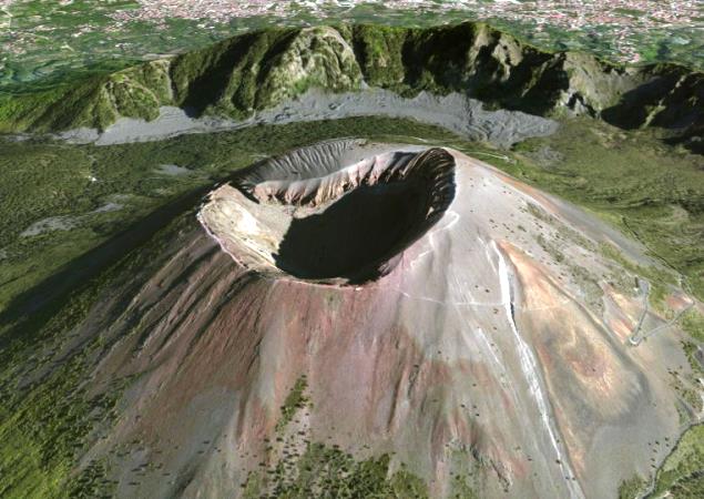
The ancient Greeks called magma "paste" to what we can understand that magma behaved like a special type of paste, which could be composed of various elements such as volatile liquids, solids and molten rocks; which was expelled with violence towards the outside or in other cases in a slow but progressive way.

So in what exact places on the planet do magma form or develop?

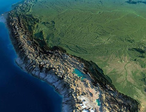
Magmatism is the process of magma formation, therefore, 80% of the magmatism of our planet occurs at the constructive edges of the tectonic plates, under the oceanic ridges, and the rest in subduction zones and in regions located in the inside of the plates, due to the effect of hot spots. (one)

Depending on the process in which we find ourselves, the formation of magma (or partial melting of the rock) will depend on the geothermal energy of the area, which we will explain in the following graph.


The graphic above presents 4 situations in which magma could form or develop. To understand the graph we have to understand that the present red line represents the geothermal curve of the area and the green line represents the temperature of the existing rocks. Furthermore, these conditions occur up to a depth of 500 km and a temperature of up to 2000 ° C. Being clear about these characteristics we can continue that:

1. In situation A, in a normal situation, where there are no ridges, no hot spots and no subduction, magmas cannot develop, since qualitatively for magma to develop or form, it is curved (geothermal and rock) must intersect with each other to start the partial melting of the rocks. And as we can see in areas of our planet where these geological conditions do not exist (subduction, hot spots or dorsal), magma cannot form or accumulate.

2. In oceanic ridge areas, the geothermal gradient increases dramatically compared to normal areas. The geothermal gradient curve before reaching approximately 10 km depth changes irretrievably to a temperature of approximately 1250 ° C, so the geothermal gradient curve qualitatively changes. This makes it intercept with the temperature curve of the rocks at approximately 40 km depth, exceeding 1250 ° C in temperature, thus forming magma in this geological condition.

The fusion under the ridges may be due to the decrease in pressure in the rocks as a consequence of their rise by convective movements, in solid, of the mantle. The rise to the surface of these primary and undifferentiated magmas is the origin of the immense basaltic masses of the ocean floor. (one)

3. Something similar happens in situation C where there is the presence of Hot Spots (hotspot) on Earth. The geothermal gradient increases steadily and progressively, compared to normal areas, until before 100 km depth, reaching temperatures of up to 1500 ° C. Before reaching depths of 100 km, partial melting of the rocks takes place, forming magma, maintaining the temperature almost constantly. Qualitatively the curves on the graph will have intersected.

4. In subduction zones, the geothermal gradient increases steadily and gradually, as if it were a normal condition, but the temperature of rocks in subduction zones decreases from 1250 ° C to 950 ° C, to depths of the 35 km.

Then, the temperature of the rocks increases little by little when we go to greater depths. Upon reaching approximately 85 km depth, partial melting of the rocks occurs, causing magma.

The fusion is produced by the increase in temperature due to the compression of the subducting lithosphere and friction with the rocks of the mantle, to which is added the water that releases and rises. Magmas are formed that will give rise to the typical batholiths of the orogenic zones. (1)

"Geophysics is the science that is in charge of the study of the Earth from the point of view of Physics. It investigates and analyzes the origin of various natural phenomena such as tsunamis, earthquakes, volcanic eruptions, etc., using indirect tools for its study by taking as a basis quantitative methods and methods based on measurements of gravity, magnetic, electromagnetic or electrical fields. " - Science and Geophysics

BIBLIOGRAPHIC REFERENCE

  (1) https://es.m.wikipedia.org/wiki/Magma

Read in Spanish

The Earth, a dynamic planet for thousands of years, has shown us its activity and energy through different physical manifestations such as earthquakes, volcanic eruptions or by the movement of its tectonic plates. All these manifestations have their origin from the interior of our planet. At several hundred kilometers deep, the Earth is a hot planet that is in motion due to the high pressures and temperatures inside, it transmits heat through the different materials and surrounding media until it reaches the Lithosphere where it is going gradually cooling down. But how is the heat inside the Earth transmitted?

The terrestrial globe is made up of rocks, metals and chemical elements that make up the geosphere, divided into three main layers. The crust that measures approximately 70 kilometers; the mantle (the intermediate layer) that is formed by rocks in a semi-solid and liquid state and has a thickness of 3,000 km and, finally, the deepest layer, the nucleus where the highest pressures and temperatures on Earth are recorded, from up to 6,000 degrees centigrade.

When the Planet formed, the Earth's crust cooled until it solidified. However, the lower layers did not do so as quickly as the crust works as an insulator, allowing the mantle and core to maintain their high temperatures. In this way, the Earth works as a great thermal machine, capable of generating its own heat and conserving it inside the globe. (one)

But the heat that is concentrated inside is not static, but is actively in motion, being transmitted from the core to the mantle in different ways. The ways in which Earth's heat is transmitted are by conduction, convection, and radiation. However, all three have different degrees of importance in the different layers of the Earth: in the crust the main means of heat transport is conduction, while in the mantle it is convection and radiation.

Conduction is the way heat is transported from a warmer body to a cooler body with which it is in contact. The efficiency of this depends on a property of the materials that is called thermal conductivity and that tells us what the temperature difference will be caused by a heat flow: the higher the conductivity, the smaller the temperature difference through the material. An example of a good conductor is a metal bar, which when heated at one end will immediately conduct heat to the other end. On the other hand, an example of a bad conductor would be wood, ceramics and air.

Convection is a slightly more complex process that occurs only in fluids (liquids and gases). As the lower part of a fluid is heated, it will expand and become less dense than the colder upper part, so it will tend to rise, so that the cold part will now be in contact with the heat source, repeating itself. forms the process and giving rise to what are called convection cells, in which there are updrafts and downdrafts. This mechanism is going to be generated from a certain value of the temperature difference and depends on the viscosity and density of the fluid.

Radiation is a form of heat transport that is important at high temperatures; In reality, all bodies that have a temperature above absolute zero (zero degrees Kelvin or -273.15 ° C) emit radiation, but the frequency of the radiation emitted is proportional to the temperature of the material: humans emit radiation in the infrared and a piece of iron heated to very high temperatures will begin to emit in the visible spectrum.

In this way we observe that the heat transport inside the Earth will depend on the temperature and the characteristics of the material. The crust behaves like a solid and has relatively low temperatures. The mantle behaves like a fluid and since convection is much more efficient in this case, this is the main means of transport, even though the relatively high temperatures make it possible for energy to also be transported through radiation. (two)

"Geophysics is the science that is in charge of the study of the Earth from the point of view of Physics. It investigates and analyzes the origin of various natural phenomena such as tsunamis, earthquakes, volcanic eruptions, etc., using indirect tools for its study by taking as a basis quantitative methods and methods based on measurements of gravity, magnetic, electromagnetic or electrical fields. " - Science and Geophysics

BIBLIOGRAPHIC REFERENCES
(1) https://www.sostenibilidadedp.es/pages/index/el-calor-de-la-tierra

(2) http://bibliotecadigital.ilce.edu.mx/sites/ciencia/volumen2/ciencia3/058/htm/sec_4.htm

Read in Spanish
Idealized image of the Earth's magnetic field.
When we study Geophysics, we find several terminologies that we must learn in each area of ​​study, in which it is necessary to know and understand them to understand the situation we are in when we find ourselves working. That is why, in Geophysics we will regularly hear the terminology of the word "field". And is that this term is quite common, so we must realize in what circumstances we are using it. For example, we can hear terms such as Field Geophysics, field work, field of Geophysics, fields of Geophysics, among others. It may be that in these terminologies there are sometimes ambiguities, but if we realize well and delve into what it means, we can understand that they are different terminologies, with different meanings although the way of appreciating them are similar.

We can refer to the word field in the work and practice of Geophysics, when we do it in the field, outside our base station, where we take the various readings with equipment, when working in Electrical, Seismic or Magnetic Prospecting, to name a few examples or when we take gravimetric data. All the data collected with the various geophysical equipment we will do in the field, in the area and / or study area.

When mentioning Field Geophysics, let's try to differentiate the work that is done outside our base station (field work) and when we refer to the study of geophysical fields. When speaking of Field Geophysics we are referring to the study of geophysical fields (whether they be magnetic, gravimetric, electrical, etc.) where we collect the relevant data in the field to work on later in the laboratory.

"... measurements in geophysical studies are done in the field, but unfortunately, many are also in the field. Field theory is fundamental to gravity, magnetic and electromagnetic work, and even particle flows and fronts of Seismic waves can be described in terms of radiation fields. Sometimes ambiguity is not important, and sometimes both meanings are appropriate (and intended), but there are times when clear distinctions need to be made. In particular, the term reading of field is almost always used to identify readings made in the field, that is, not at a base station ... "(1)

When we talk about fields in Geophysics, we also want to refer to the existence of natural fields and artificial fields. This means that the natural fields are going to be those that are naturally generated, such as the gravity field or the magnetic fields. Instead artificial fields are going to be created by us, when we inject alternating currents, for example, to generate electromagnetic fields.

"... Geophysics is the science that studies the Earth from the point of view of physics. Its object of study covers all phenomena related to the structure, physical conditions and evolutionary history of the Earth. Being a mainly experimental discipline , uses for its study physical quantitative methods such as the physics of reflection and refraction of mechanical waves, and a series of methods based on the measurement of gravity, electromagnetic, magnetic or electrical fields and radioactive phenomena. In some cases, these methods take advantage of natural fields or phenomena (gravity, earth magnetism, tides, earthquakes, tsunamis, etc.) and in others they are induced by man (electric fields and seismic phenomena) ... "

BIBLIOGRAPHIC REFERENCE
(1) FIELD GEOPHYSICS.pdf, Pag.16.

Leer en Inglés
Imagen idealizada del Campo Magnético de la Tierra
Cuando estudiamos Geofísica, nos encontramos con varias terminologías que debemos aprender en cada área de estudio, en la que es necesario conocer y entenderlas para comprender la situación en la que estamos cuando nos encontremos trabajando.  Por eso es, que en Geofísica escucharemos con regularidad la terminología de la palabra "campo". Y es que este término es bastante común, por lo que debemos darnos cuenta en qué circunstancias estamos empleándola. Por ejemplo, podremos escuchar términos como Geofísica de Campo, trabajos de campo, campo de la Geofísica, los campos de la Geofísica entre otros. Puede ser que en estas terminologías existan en algunas ocasiones ambigüedades, pero si nos damos cuenta bien y ahondamos en lo que quiere decir, podremos entender que se tratan de terminologías diferentes, con significados diferentes aunque la forma de apreciarlas sean similares. 

Podemos referirnos a la palabra campo en el trabajo y práctica de la Geofísica, cuando la realizamos en el campo, allá afuera de nuestra estación base, donde tomamos las diversas lecturas con equipos, al trabajar en Prospección Eléctrica, Sísmica o Magnética, por citar algunos ejemplos o cuando tomamos datos gravimétricos. Todos los datos recolectados con los diversos equipos geofísicos lo haremos en el campo, en la zona y/o área de estudio.

Al mencionar a la Geofísica de Campo, tratemos de diferenciar el trabajo que se realiza fuera de nuestra estación base (trabajos de campo) y cuando nos referimos al estudio de los campos geofísicos. Al hablar de Geofisica de Campo nos estamos refiriendo al estudio de los campos geofísicos (ya sean magnéticos, gravimétricos, eléctricos, etc.) donde recogemos los datos pertinentes en el campo para trabajarlas luego en laboratorio.

"...las mediciones en estudios geofísicos se realizan en el campo, pero desafortunadamente, muchas también son de campo. La teoría de campo es fundamental para la gravedad, el trabajo magnético y electromagnético, e incluso los flujos de partículas y los frentes de ondas sísmicas se pueden describir en términos de campos de radiación. Algunas veces la ambigüedad no es importante, y algunas veces ambos significados son apropiados (y previstos), pero hay ocasiones en que es necesario hacer distinciones claras. En particular, el término lectura de campo casi siempre se usa para identificar lecturas realizadas en el campo, es decir, no en una estación base..."(1)

Cuando hablamos de campos en la Geofísica, también queremos referirnos a la existencia de campos naturales y campos artificiales. Esto quiere decir, que los campos naturales van a ser aquellos generados de forma natural, como el campo de la gravedad o los campos magnéticos. En cambio los campos artificiales van a ser creados por nosotros, cuando inyectemos corrientes alternas, por ejemplo, para generar campos electromagnéticos.

"...La geofísica es la ciencia que estudia la Tierra desde el punto de vista de la física. Su objeto de estudio abarca todos los fenómenos relacionados con la estructura, condiciones físicas e historia evolutiva de la Tierra. Al ser una disciplina principalmente experimental, usa para su estudio métodos cuantitativos físicos como la física de reflexión y refracción de ondas mecánicas, y una serie de métodos basados en la medida de la gravedad, de campos electromagnéticos, magnéticos o eléctricos y de fenómenos radiactivos. En algunos casos dichos métodos aprovechan campos o fenómenos naturales (gravedad, magnetismo terrestre, mareas, terremotos, tsunamis, etc.) y en otros son inducidos por el hombre (campos eléctricos y fenómenos sísmicos)..."

REFERENCIA BIBLIOGRÁFICA
(1) FIELD GEOPHYSICS.pdf, Pag.16.

TAMBIÉN TE INTERESARÁ
Monitoreo Geofísico | Alfred Wegener. ¿Geofisico o Geologo? | Software Geofísico | La Geofísica y las Matemáticas | Desastres naturales y desastres geofísicos | Existencia de ondas gravitacionales | ¿Cómo se transmite el calor interno de la Tierra? | Desarrollo de magma | Monitoreo Geofísico