


GEOPHYSICAL!
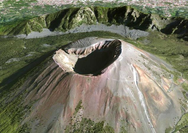
Lately it is observing the application of so-called Drones, which are only intended for Unmanned Aircraft Remote Control from great distances from a control center . The Drones allow studying climate systems and ecosystems, and have other interesting applications help us to see the volcanoes .
It is in this way that if a volcano erupts can be sent to observe the volcano with the Drone and take photographs or videos during the volcanic event . Practically we can see the eruption from an angle that would be impossible for a normal volcanologist observe.
Thus it could just send a Drone to observe Yasur Volcano on the island of Tanna , in Southeast Asia , when erupted . In the video of this post you can see the emission of ash, magmatic material being ejected and giving the impression that impact the drone .
With this kind of technical equipment both geologist and geophysicist may be able to study the behavior of volcanoes when they are erupting . Maybe with time can be included in these special devices geophysical drones to further study the volcano in question.
What you will find interesting or useful to use these drones ?


0 Comments:
Publicar un comentario
No olvides de escribir tu opinión personal de nuestro blog, una página o información que desees comprtir. Todos los éxitos para ti. Gustavo Zavala.