Contacto : cgeofisica@gmail.com

Ciencia y Geofísica

Grupo IGPERU

Ciencia y Geofísica

facebook
instagram
linkein
whatsapp
  • Meteorología y Climatología

    Estudiamos el comportamiento de los fenómenos atmosféricos!

  • Volcanología

    Estudiamos el comportamiento de los volcánes!

  • Prospección Geofísica

    Estudiamos técnicas físicas y matemáticas, aplicadas a la exploración del subsuelo para la búsqueda de recursos naturales y yacimientos minerales.

  • Geotermia

    Estudiamos los fenómenos térmicos que tienen lugar en el interior de la Tierra.

  • Tectonofísica

    Estudiamos la dinámica y cinemática de los procesos que deforman a la litosfera mediante métodos cuantitativos.

  • Geomagnetismo

    Estudiamos las propiedades magnéticas de la Tierra.

  • Inteligencia Artificial

    Aplicando los conocimientos en Inteligencia Artificial para convertir la Geofísica más inteligente.


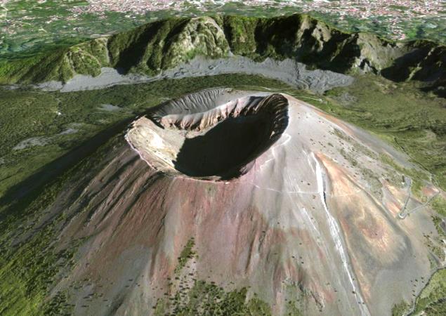
Estudiar los volcanes existentes en cualquier área o región en forma remota o insitu, recolectando datos de campo, muestras de ceniza para su análisis químico o registrando los sismos volcano tectónicos producidos por el volcán en sí es muy interesante y emocionante. ¿Pero que pasaría si recolectas toda esa información en una sola data y lo que generas en forma virtual donde puedes manipular los datos directamente?

Todo geofísico está en la capacidad de poder hacerlo, con los conocimientos técnicos adecuados se pueden realizar simulaciones muy diferente a las visualizaciones 3D generados por computadora. De esta forma se puede obtener una idea más clara de lo que está pasando en el volcán. Y si a eso le agregamos la simulación en tiempo real sería mucho mejor. La data geofísica obtenida en campo es lo que recuperamos en una hora y tiempo determinado para posteriormente transformarla en una data más sólida y consolidarla en una imagen 3D más realista. Datos GPS, latitudes y longitudes de los sismos, magnitudes o profundidades son importantes para el desarrollo de esta herramienta visual más impactante y profesional.

Estos modelos nos ayudan a entender mejor la evolución de la sismicidad bajo el volcán y cómo esta va migrando en las inmediaciones del edifico volcánico. La distribución de los sismos modelados nos muestra la actividad sísmica relacionada a procesos de fractura de rocas originados por la dinámica eruptiva del volcán.

Una de las herramientas que podemos utilizar para el desarrollo de volcanes en 3D es el Software ArcGis con su visor 3D de Esri.


El vídeo mostrado es la presentación del Mapa Sísmico del volcán Misti en Perú - Arequipa donde se puede observar claramente los hipocentros de los sismos con sus respectivas profundidades, claro ejemplo de la herramienta fundamental para el análisis, estudio, evolución y comportamiento de un volcán.

Puedes ver más Volcanes en 3D ingresando desde aquí

Descarga nuestro e-book acerca del desarrollo de volcanes en 3D en nuestra tienda online!

Mantente al tanto ya que estaremos actualizando constantemente este post.

REFERENCIAS.
Instituto Geofísico del Perú

TAMBIÉN TE INTERESARÁ
Monitoreo Geofísico | Alfred Wegener. ¿Geofisico o Geologo? | Software Geofísico | La Geofísica y las Matemáticas | Desastres naturales y desastres geofísicos | Existencia de ondas gravitacionales | ¿Cómo se transmite el calor interno de la Tierra? | Desarrollo de magma | Monitoreo Geofísico


In 1912 Alfred Wegener began his studies in the Theory of the Continental Drift but in his beginning it was discarded since his theory lacked a mechanism to explain the drift of the continents. In his original work, he proposed that the continents move on another denser layer of the Earth that made up the ocean floor and what extended beneath them.

For the year 1960 the Theory of the Continental Drift and the Expansion of the Oceanic Fund were included in the Theory of Plate Tectonics. According to this theory, the displacement of the continents has happened for thousands of years with the global convection of the mantle, causing the lithosphere to be reconfigured and permanently displaced. Originating in this way earthquakes around the world.

The Earth is divided into three parts. The innermost and warmest, the core, with temperatures higher than 6000 degrees Celsius, main participant in the generation of heat of our planet. Continue the middle part. the Mantle, and finally the coldest part of the planet where it shelters life, the Lithosphere. Who gives their own heat to our planet is the Nucleus, behaving like a large nuclear reactor, transmitting the heat of the Nucleus to its surface. But how does the Mantle react to the high heat and temperature exposed by the Core?

Everything starts in the Nucleus. With the radioactive decay of its heavy elements such as thorium, among others gradually heating everything around. The physical properties of the materials allow the transfer of heat to the areas closest to the Lithosphere. But on the way they lose their heat capacity gradually cooling. Due to the difference in density between the materials, the material with higher density returns to the mantle, while the materials that have lower density ascend transforming into a continuous and repetitive cycle. This is called Mantle Convection.

In if the convection of the mantle occurs in the upper mantle. This reaches up to 700km. of approximately depth. It is made up of generally solid materials but flows because it is close to its melting point. It is hotter in its central zone and colder on the surface than what we understand as a Geothermal Gradient. You lose heat by driving through the lithosphere.

But how does convection occur?

Most of the mantle is fluid because the core is responsible for heating it to near its melting point. Because of its fluidity, convection currents are produced by transporting the hottest and least dense material to the surface.

The material of the mantle flows horizontally and in contact with the lithosphere loses heat and increases its density and when it is sufficiently dense it starts to descend. In the descent and horizontal travel in contact with the lower mantle it is heated again to ascend again. This is also called convection cells.

But is it possible that these convection currents are trailed throughout the planet?

The displacement movement of the tectonic plates is not in one direction, they do it in different directions. So that would give a perspective that in the mantle not only a global convection but several are produced.

Some interpretations on hypotheses presented on the movement of the plates is that for each plate there is a movement of its own convection. But is this true? If we observe the tectonic plates of the whole planet we can realize that there are some of them that are of sizes and / or of greater proportions than other plates, so to hold the hypothesis of a convection cell for one of these giant plates would lack basis. This is because in order for a tectonic plate of greater proportions to move, it would need an even larger convection cell than the others extending deeper into the mantle.

So how do they move? One of the current hypotheses that is being handled is that there are convection cells that extend only in the upper mantle up to 700km deep. To more depth there are other currents of convection that would feed the convection cells located in the upper mantle giving them the energy necessary to move the plates.